|
Many thanks for permission to use graphics from their software and toposheets |
|
|
page 3 Waiheke IslandTo the CascadesA widely recommended destination. I suspect the people who recommend it are referring to the one or two days a year that Waiheke experiences excess rainfall. This was probably the first or second sunny day after a long period of more or less continuous wet, on the mainland at least, and still not much to show for it. But the process of getting there is still worth the effort.
We move on again through a nikau nave. We've used up all our water, having left one of the containers behind on the bench, and we're missing that by this stage.
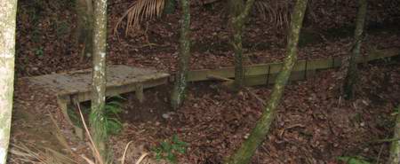
We do appreciate the work that Conservation and ARC staff put into keeping the walking tracks maintained to a very comfortable standard.
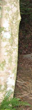
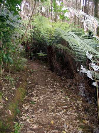
The lacework of lichen on some of the tree trunks is exquisitely delicate.
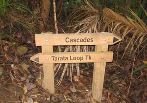
We pass the junction with Nikau Track and head on until we intersect with the big Central Track. Tarata Loop track continues to the right of the picture. My legs are beginning to protest, and I'm ready for a ten minute stop and a snack. The latest batch of biltong is an exceptionally nice one but I'd like some water to accompany it.
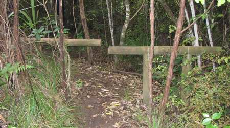
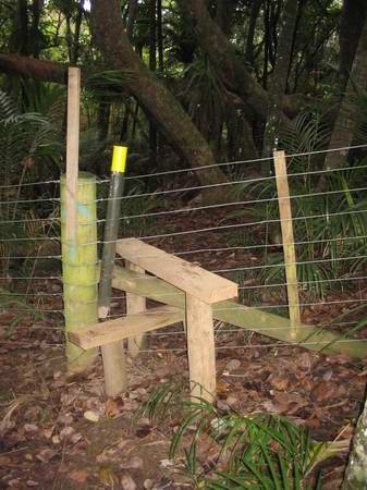
I don't know who gauges the distance apart on these barriers, but between me and the pack there's not a lot of room left over as we slip through. I'm not dry, but I am certainly at one of the early stages of water deprivation in that I am beginning to get a little grumpy. Not so you'd notice, mind, but definitely grumpy, all the same (generally a function of slowly increasing self-pity). I tell myself I will fill the bottles at the Cascades, there's probably a ton of fast-moving oxygenated water pouring down there, and I'll be able to drink all I want. We head onwards.
About 100 metres or less from here.
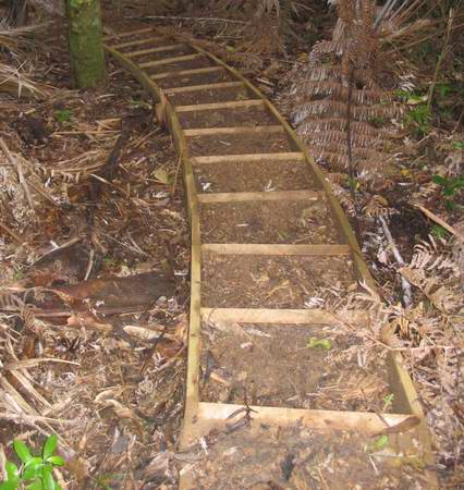
On down to the Cascades and the graceful curve of this set of tanalised pine steps suggests that in some humble craftsman there beats the heart of an as-yet-unrealised artist. I remove my hat briefly in acknowledgement, and head down them.
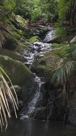
Cascades? I look around for the rest of the Tui ad. I've seen more water coming from a leaky 50mm alkathene pipe in the Woodhill Forest. And certainly cleaner water. B*gg*r! My self-pity index climbs some more.
We head back up. It is still our plan at this point, to strike Carson's Rd and make our way to the airstrip to see whether it is possible to walk up the side of it. However, a track off to the right proclaims itself to be the Mamaku Track, Onetangi and return 3 hrs. If this one goes to Onetangi it has to get us past the airstrip and as we're east of the strip, we'll have to strike the Ecovillage property somewhere along here, adjoining Trig Hill Rd. We arrive at the reserve boundary, well fenced, but beckoning us onwards.
My legs are beginning to throb, and as always when water is short my attention focuses on my discomfort rather than the beauty around us. But I give it a stab.
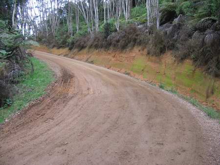
We emerge onto the extension of Carson Rd leading down to the paintball, and indeed there are paintball guns going off madly down below us as people move up one step from video games. The brown surface of the road is not clay but stems from a high manganese content in the local gravel supplies. There is debate about the respective contributions of this gravel and the salty Waiheke atmosphere to the intricate patterns of rust that characterise much of the island's car fleet. At this point, the chip in the camera is full, and though I replace it and shoot a number of pix in the next hour, none of them will show when I remove the new chip later at home. We continue along to the east of the airport, for a short period separated from the paint ball by elaborate screens. and after a time that is becoming increasingly burdensome, we emerge at the gate of the Peacock Vineyard at the end of Trig Hill Rd. It is as we are attempting to orient ourselves to Linda's sketch map that my grumpiness momentarily surfaces for all to see at about the same time that Miranda's mapreading and orientation skills need extra patience and careful tact to get us pointing in the same direction. A public walking track leads from the top of Trig Hill Rd, where we are, to the far gate of Awaawaroa Ecovillage and onto Awaawaroa Rd. It is not signposted at all on Trig Hill Rd, but we climb over the fence - not a completely safe procedure when you're 120 kg and the staples holding the wire are only half hammered home - and eventually locate a gate on the other side of the paddock from which there are a number of white and yellow poles visible leading down hill. We follow these down, past the point where the poled track veers off and follow Linda's instructions to find her caravan. Kettle on quick smart, and a large swallow of cool clean water from the caravan supply. We change into dry warm clothes as it is suddenly becoming chilly, and pull out the home-dried bolognese sauce and the noodles that will be our evening meal, and put the sauce on to soak for half an hour. The kettle boils, and the mug of hot tea is heavenly. Linda's caravan, bless her, is amply supplied with cushions and we lean back and relax. We reckon, in our state of fitness, we have probably walked about 90 minutes too far, about 6.5 hours for the day, though how much difference an ample supply of water would have made is an open question.
|
|